
The groundhogs were right: winter is not over yet.
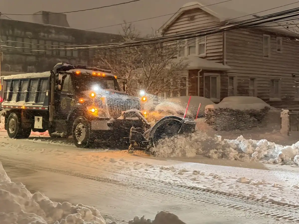
The most extensive local blizzard in a decade covered parts of Long Island with more than 24 inches (60 centimeters) of snow overnight from Sunday, February 22 to Monday, February 23, according to the National Weather Service (NWS), which reported snow accumulations of more than 29 inches (73 centimeters) in Islip and wind gusts of 84 mph (135 km/h) in Montauk.
New York Governor Kathy Hochul declared a state of emergency, as did many local municipalities, before the arrival of the blizzard.
“It’s a historic storm,” Upton-based NWS meteorologist Nelson Vaz told longislandpress.com . “This is something that an entire generation will remember.”
The blizzard occurred when the snow and ice had not yet completely melted after the last snowstorm left more than 1 foot (12 inches / 30 centimeters) in the area on January 25, before a hard freeze set in that prevented the accumulation from melting.
“Black ice is possible throughout the region (Monday night), especially on untreated surfaces,” the NWS stated in a special weather statement. “Gusty winds could also reduce localized visibility due to snow blowing into Tuesday morning. Please be careful if you travel, especially during the Tuesday morning commute.”
Nassau and Suffolk counties also had a travel ban through Monday, with the exception of essential workers and snowplow operators. Many school districts in Nassau and Suffolk counties canceled classes for Monday and Tuesday, adding extra days off to the end of winter break. Flights were canceled and the Long Island Railroad (LIRR) suspended service at 1 a.m. Monday.
Likewise, PSEG Long Island warned that wind gusts could be “strong enough to down trees, knock down wire branches and cause power outages.” The utility company said it has personnel ready to respond safely and as quickly as possible during the storm. More than 16,000 PSEG Long Island customers were without power as of noon Monday, and 3,000 remained without service as of 8 p.m.
The storm also caused coastal flooding and beach erosion in coastal areas. Damage reports included a snow plow that rolled on its side on Sunrise Highway in Bay Shore, a vehicle that crashed into a fire hydrant and caused flooding in Speonk, and countless downed trees.
The 29 inches of snow might be the most snow seen at Long Island’s MacArthur Airport in Ronkonkoma, the NWS’s official weather station, but the most snow in a day on Long Island generally exceeds 30 inches, Vaz said.
Below are total snow accumulation reports from the NWS (as of 7:30 p.m. Monday):
–SUFFOLK:
Central Islip 31″
East Islip 30″
North Patchogue 30″
Babylon 29.5″
Islip 29.1″
Holbrook 29″
Nesconset 28.8″
Shirley Airport 28.5″
Bay Shore 28.2″
Montauk 28.1”
Medford 27.8″
East Farmingdale 27.5″
Remsenburg-Speonk 27.5″
Orient Point 26.5″
Quogue 26″
Southampton 26″
Islip 25.3″
Lindenhurst 25″
Shinnecock Hills 25″
Bay Shore 24.7″
Lindenhurst 24.3″
Davis Park 24.2″
Babylon 24″
Ridge 24″
Southampton 24″
Iceland 23.5”
Mattituck 23.3″
Flanders 23″
Hauppauge 23″
Islip Terrace 23″
Lake Ronkonkoma 23″
Middle Island 23″
West Islip 22.8″
Manorville 22″
Shelter Island 21.1″
East Northport 21″
Ridge 20.7″
Oakdale 20.5″
Riverhead 20.2″
East Patchogue 20″
Nesconset 20″
Upton (NWS Office) 19.8″
Riverhead 19.7″
Stony Brook 19.7″
Ridge 19.6″
Amityville 19″
Commack 19″
Bellport 18″
Smithtown 17″
Rocky Point 17″
Jamesport 16.6″
Copiague 16.5″
Centerport 16″
Islip Terrace 15″
Northport 15″
Greenlawn 11.3”
– NASSAU:
North Merrick 25.4″
East Massapequa 24.5″
Bethpage 24.4″
East Massapequa 24.4″
Lynbrook 24″
Plainview 23.8″
East Meadow 23.7″
Plainview 23.2″
South Massapequa 22.4″
Wantagh 22″
Elmont 21.5″
Bellmore 21″
Glen Cove 19″
Levittown 19″
Malverne 18.5″
Westbury 18″
East Williston 16.9″
Syosset 16.3″
Sea Cliff 15.8″
Jericho 15.2″